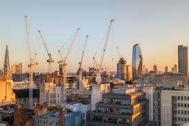
A new report by Arup for the mayor of London has highlighted the worsening issue of heat risk in our city centres as summers get steadily hotter. Tom Lowe reports.

London 2022 heatwave shutterstock

The 2022 summer heatwave was the UK’s hottest on record, with temperatures hitting 40°C in London

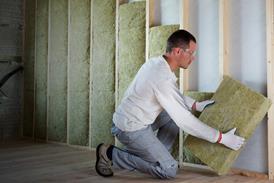
Anyone who has worked from home in London will know the trauma of a summer heatwave. Everyone who has endured sitting at a desk during long afternoons of internal temperatures approaching levels that could fire pottery will have learnt a different coping mechanism, whether it is drawing the curtains to stop the sun getting in, setting up multiple fans or running to the bathroom for cold showers between Zoom meetings.

There is no doubt that London is getting hotter, and will continue to heat up in the years to come. The 2022 July heatwave was the UK’s hottest on record, topping 40°C for the first time in the country’s recorded history.

While the summer of 2023 was more forgiving, temperatures still hit 33°C in parts of London in September. Before the days of remote working, this kind of heat for those working in air-conditioned offices was an opportunity for a pleasant lunchtime walk. Now, it is a serious issue for health as well as productivity.

It also affects other building types, from schools and hospitals to care homes. While the industry is focused on how to insulate buildings to make them warmer in winter, there is a whole other retrofit job needed to keep them cooler in summer. Given the capital’s vast building stock, the problem facing cash-strapped local authorities is where to start.

Last year, the Greater London Authority (GLA) commissioned a report by Arup looking into the parts of the city most vulnerable to heat exposure. The newly published research aims to give councils insights into where retrofit work is most needed to keep buildings cool.

It found that there is a direct correlation between higher heat risk and areas which have greater socioeconomic deprivation. It also found that new-build homes, particularly apartment blocks, are more susceptible to overheating than period properties.

>> See also: City-wide roof retrofit could keep London cool as summers warm, says Arup report

A team of 12 people worked on the report for four months during the summer of last year. It followed an earlier piece of work by Arup looking at urban heat intensity in the centres of seven major cities, including London. The new report has focused on the vulnerabilities of different areas based on building types and the age and economic status of their occupants.

It has been made possible by the mass democratisation of the satellite industry over the past few years. Damien McCloud, Arup geospatial and Earth observation specialist and the report’s project director, said the wealth of newly available data has revolutionised this type of research.

In a similar report written 10 years ago, McCloud and his team could only include basic levels of data. In the new report, multiple observation layers could be combined into a larger model to provide much more detailed insights into heat behaviour at ground level. 

“It’s about the size of the data processing that we can do now to give a resolution of data that wasn’t available before,” he says. This includes not just an improved pixel size but the ability to look back in time to compare how cities are changing. 

EU satellite shutterstock

The report was made possible by open source data from the EU’s Sentinel satellite constellation

Using open source data from Sentinel, the European Space Agency’s satellite constellation, the Arup team measured land surface temperature and albedo, the amount of light reflected by buildings. This was combined with public data on different building types to build up a picture of where heat was having the most impact.

While some data was missing, enough was available to create a scoring mechanism of heat vulnerability. For schools, hospitals and care homes, researchers used data from the London School Atlas, UK Medical Site Data and the Care Quality Commission. For housing, the team looked at EPC certificates, which contain information on property types and the age of properties, allowing a calculation of air tightness.

>> See also: Are you ready for a heatwave summer?

City centres are warmer on average than lower density neighbourhoods. While this “urban heat island” effect can ward off the worst of the cold in the winter, in the summer these areas are prone to dangerously high temperatures. This is particularly the case in new-build blocks of flats, where high levels of air tightness often result in poor ventilation.

Where the report differed from previous research was that it looked into how the behaviour of people who live in these types of buildings affected their heat vulnerability.

“If you’ve got a flat in a neighbourhood with high noise pollution rates and air pollution rates, people are not going to want to open their windows,” the report’s project manager and main author Dimple Rana, an Arup environmental and building physics engineer, says.

“If paired with that, you’ve got things like just air tightness of the building, then you’re just going to keep that heat in. So there are multiple factors that can impact how a building overheats, but flats tend to be at a bit of a higher risk, just because of some of the other challenges that go with it.”

Properties Vulnerable to Heat Impacts in London: a report by Arup for the GLA

The research team created a series of maps for different building types, combining three layers focusing on property vulnerability, socioeconomic vulnerability and heat hazard to provide a colour-coded scoring system by neighbourhood. 

For schools, the risk was markedly greater in the eastern half of the capital. Tower Hamlets, Hackney and Islington were among the worst affected boroughs, while schools in the wealthier boroughs of Westminster and Kensington & Chelsea were almost unaffected by overheating.

Further to the west there are pockets of severe risk, and a large area at the northernmost part of Enfield, on the edge of London, with the highest risk level. This was attributed to high socioeconomic and property vulnerability for schools in this area.

For hospitals, Westminster was among the worst affected boroughs, although a larger area of risk was found in the central east of the city, particularly at Barts Health NHS Trust, Barking, Havering and Redbridge University Hospitals NHS Trust, Homerton University Hospital NHS Foundation Trust, Whittington Health NHS Trust and University College London Hospitals NHS Foundation Trust.

Care homes have the greatest spread of risk across London of the four surveyed building types. This is because of the greater vulnerability of care home residents, although those in central London were found to have a relatively higher risk due to the higher temperatures in these areas.

Housing most at risk from overheating was located in Hackney, Tower Hamlets, Islington and Camden, boroughs which have a higher proportion of apartment blocks. Areas towards the outskirts such as Bromley, Havering and Hillingdon show the lowest heat risk.

The prospect of having to rethink retrofit work done on properties to make them warmer during the winter without addressing the issue of poor ventilation could be a serious headache for councils. “Generally, our housing stock has been designed to keep the heat in rather than for it to be cold,” McCloud says.

“That’s almost a paradigm. You have to challenge that standard way of thinking about keeping heat in rather than keeping heat out. 

“And this report, to a certain extent, is challenging that thinking. There is a risk here – and there is vulnerability across the city, and we have to address it.”

GLA_29526700_CombinedSchoolsRanking (1)

A map from the Arup report showing the heat vulnerability of schools in different areas of London

The ability to use satellites to look backwards and forwards in time allows researchers to investigate where retrofit work has been done to see how well it has performed and if heat has reduced. While this work has not yet been done by Arup, McCloud says there is now a “vast” quantity of data for researchers to work through. 

“It’s the ability to give that understanding so [Arup], and others can use that data to inform the GLA, to inform local boroughs and to inform local government,” he says. 

Arup has used the satellite data to develop a digital tool called UHeat, which was used in the creation of the report. It could also be used to suggest planning policy to the GLA and councils based on comparisons of historic satellite observation.

“One of the capabilities of something like UHeat is that we can do some scenario testing,” says Rana. “The input data that goes in is based on what’s actually there right now. But, if we want to look at increasing our trees by 20% across an area, what impact would that have?”

>> See also: Things can only get hotter – so we must tackle overheating in buildings

Other suggestions could include increasing the albedo of roofs in high-risk areas or increasing the amount of water, which has a cooling effect. Soft surfaces like soil also absorb heat, as opposed to hard surfaces, which tend to retain heat and then radiate it at night, resulting in heat levels staying high into the evening.

“That is really the next step for us,” Rana concludes, “because we want to move from understanding cities to actually then thinking about responding and coming up with adaptation measures and preparedness.”