


Online facility will provide maps showing property-related and geographical features
A new mapping tool has been launched that aims to cut down the time it takes property professionals to gather planning and environmental information.
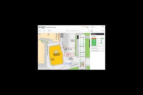
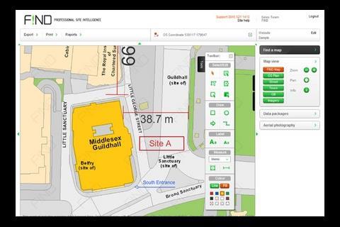
The basis of the online tool are maps, adapted from Ordnance Survey's MasterMap series, which are colour coded to highlight property-related and geographical features.
Find uses data from sources including English Heritage, English Nature, the Environment Agency and local authorities, can be displayed graphically over the map in relation to a specific site. Typical information might include local listed buildings, conservation areas, post code and flood mapping. The data is provided in layers which can be simultaneously turned on and off.
Using the tool site areas can also be measured quickly and simply, providing assessment of development potential and maps can be downloaded, allowing users to add their own annotations, graphics and logos.
Find also offers aerial photography for instant download. This includes historic and high detail images.
Information on listed buildings and built heritage is free while other data is available on a pay-as-you-go basis from as little as £1.
http://www.findmaps.co.uk/


No comments yet