


This module, sponsored by LandTech, provides built environment professionals with a clear and practical understanding of the evolving Green Belt policy landscape, with a focus on identifying and assessing grey belt sites for sustainable development

As pressure mounts to deliver new housing and infrastructure in England, the Green Belt – long considered sacrosanct – is once again at the centre of planning debate. While the policy was originally introduced to prevent urban sprawl and protect the countryside, questions are increasingly being raised about whether all land within the Green Belt still fulfils its intended function.
In response, a new classification known as the “grey belt” has emerged: land that is technically within the Green Belt but may no longer serve its strategic purposes. This module explores the policy, planning and data considerations around identifying grey belt land and unlocking its development potential.
Learning objectives
- Ability to explain the purpose and evolution of Green Belt and grey belt policy
- Awareness of recent national policy changes that affect grey belt development
- Understanding of planning tests to evaluate the suitability of sites for development
- Knowledge of data tools to support site identification and assessment.
The concept of grey belt aims to inject more nuance into the planning system, recognising that not all land within the Green Belt holds the same value or purpose. With mounting housing needs, constrained local plans and policy shifts from central government, built environment professionals must develop a more evidence-led and context-sensitive approach to land assessment.
Ultimately, the aim is to support more strategic and sustainable decision-making to help the evolving use of Green Belt policy deliver value for communities, the environment and the development sector.
Introducing grey belt policy
Grey belt policy has emerged as a pragmatic response to the longstanding tensions within England’s approach to land use planning. Devised in the post-war era, the Green Belt policy was created to restrict the outward expansion of urban areas and maintain a clear separation between towns and cities. While it has been largely successful in achieving this core objective, the policy has also generated several unintended consequences, particularly as the demand for new housing and sustainable infrastructure has grown.
One of the central misconceptions about the Green Belt is that it represents a high-value environmental protection. In reality, the Green Belt is a planning designation focused on controlling development, rather than protecting ecological or landscape quality. Many areas within the Green Belt are of limited environmental or public value. These can include monoculture farmland with little biodiversity, inaccessible or derelict sites, and previously developed land that no longer contributes meaningfully to the original aims of Green Belt designation.
Grey belt policy seeks to bring greater nuance to how this land is understood and managed. Rather than treating the Green Belt as a blanket constraint, it encourages a more evidence-based assessment of which parts of the land still serve a useful planning purpose – and which do not. Green Belt land serves five purposes, which are established by paragraph 143 of the National Planning Policy Framework (NPPF). These are:
- To check the unrestricted sprawl of large built-up areas
- To prevent neighbouring towns merging into one another
- To assist safeguarding the countryside from encroachment
- To preserve the setting and special character of historic towns
- To assist in urban regeneration, by encouraging the recycling of derelict and other urban land.
Grey belt land refers to land that lies within the Green Belt that is not affected by the constraints listed in footnote 7 of the NPPF. These parts of the Green Belt are not protected by strict national environmental or heritage designations (such as Sites of Special Scientific Interest, National Parks, flood zones or areas with important habitats or heritage value). In addition, grey belt land is land that does not strongly meet three of the key purposes of Green Belt: preserving urban sprawl, stopping towns from merging and protecting the setting of historic towns. This means that grey belt land may be less sensitive and more suitable for reconsideration through the planning system.
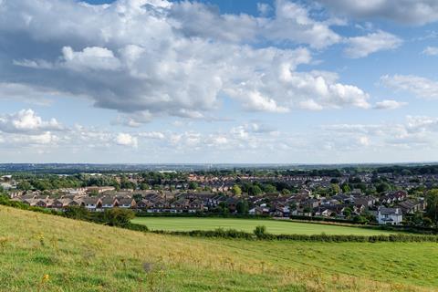
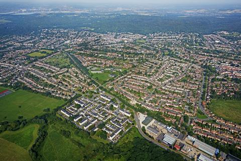
Examples of grey belt land may include disused petrol stations, neglected industrial plots and surplus infrastructure, or land surrounding existing settlements that can be demonstrated to meet the above criteria. These areas may be close to existing transport connections, schools or services – making them potentially suitable for development. Unlocking such sites could help address housing shortages while preserving the more valued and functional elements of the Green Belt.
Grey belt represents a shift away from a binary view of land use, offering a more flexible and context-sensitive framework for local authorities, developers and communities to navigate complex planning decisions.
As the planning system adapts to new challenges – from population growth to climate resilience – grey belt policy encourages a more balanced, data-led and place-based approach to reconciling development pressures with land protection.
Policy context and recent developments
Grey belt policy has gained momentum through a series of planning reforms introduced since the Labour government took office in 2024. Central to this shift are updates to the NPPF and the Planning Practice Guidance (PPG), which now provide clearer direction on how local authorities can assess and release Green Belt land that no longer serves its intended purpose.
To support this work, the government has allocated targeted funding, offering £70,000 to eligible local authorities to undertake detailed Green Belt reviews. This investment recognises the complexity and resource demands of assessing Green Belt land at a granular level and reflects a broader policy commitment to unlocking development opportunities where they align with strategic need.
These reviews mark a departure from previous approaches. For the first time, grey belt principles are being actively incorporated into formal assessment processes. This means authorities are now expected to distinguish between land that continues to serve Green Belt purposes and land that may be suitable for development under a more nuanced and locally responsive framework. As a result, grey belt policy is moving from concept to implementation, with planning guidance and funding mechanisms aligned to support practical delivery.
Identifying development sites within the Green Belt: the five tests
With the grey belt policy context now clarified, attention turns to how planners and developers can practically assess land within the Green Belt for its suitability for development under grey belt principles. The PPG sets out five key tests that must be applied when considering whether development on Green Belt land might be deemed ‘not inappropriate’. Together, these tests ensure that site selection is robust, justified and aligned with both national and local planning goals.
- No fundamental harm to Green Belt purposes. Development of the site in question must not compromise the original five purposes of Green Belt for the remaining Green Belt land, when looked at as a whole.
- Demonstrable unmet need. There must be clear evidence showing that there is an unmet need for the type of development proposed, typically in relation to housing. This can be demonstrated using the Presumption in Favour of Sustainable Development tests, which assess:
- Whether housing delivery is at least 75% of the adopted housing target
- Whether the local authority maintains a five-year supply of housing land
- Whether the adopted local plan is up to date (i.e. adopted or reviewed within the last five years).
Recently, two of these tests have become significantly more difficult for most local authorities to meet due to increases in housing targets under the revised Standard Method for Calculating Housing Need.
- Sustainable location. Sites must be well-connected by public transport and close to existing services and infrastructure, supporting low carbon development patterns.
- Compliance with golden rules. A site must deliver the following: 50% affordable housing (or 15% above policy), new green space and enhanced local infrastructure.
- Designation as a grey belt site. The site must meet the criteria outlined in figure 1 of the PPG. This means it is not affected by footnote 7 constraints and it does not strongly serve Green Belt purposes
To apply these five tests effectively, planners must begin with a clear understanding of what qualifies as a grey belt site. This is not based on visual character or previous use alone, but on specific planning criteria now embedded in national guidance. The following section outlines these criteria and explains how they underpin the classification of land as grey belt.
What is a grey belt site?
Figure 1 of the PPG provides a formal definition of a grey belt site, based on two key criteria. These are designed to ensure that land brought forward under grey belt policy is both developable and strategically appropriate.
01. Free of footnote 7 constraints
To be considered grey belt, a site must not fall within areas subject to high-level national protections, sometimes referred to as footnote 7 constraints in the NPPF. These include:
- Flood risk zones
- Designated heritage assets, such as listed buildings and conservation areas
- Environmental designations, including sites of special scientific interest (SSSIs) and special protection areas (SPAs).
These constraints represent planning priorities that typically override development potential, regardless of Green Belt status.
02. Limited contribution to Green Belt purposes
The site must also be shown to have minimal strategic value in terms of Green Belt function. Specifically, it must not strongly serve three of the five purposes outlined in the NPPF, with particular focus on:
- Preventing the unrestricted sprawl of large built-up areas
- Preventing neighbouring towns from merging
- Preserving the setting and special character of historic towns.
Sites that are disconnected from strategic Green Belt functions and are not subject to overriding constraints can be assessed more favourably under grey belt policy. This creates a clearer pathway for local authorities and developers to make evidence-led decisions about land release and allocation.
Understanding what defines a grey belt site requires a detailed evaluation of how the land relates to the fundamental Green Belt purposes. The next step is to apply a consistent national methodology to assess a site’s contribution to key Green Belt objectives.
Evaluating the Green Belt purposes
A rigorous and nationally consistent approach is used to determine whether a site strongly supports Green Belt purposes A, B or D, as set out in the NPPF. This assessment ensures that land release decisions are based on objective spatial criteria rather than subjective judgment.
Purpose A: Preventing sprawl
This purpose relates to controlling the outward expansion of large built-up areas. Evaluation typically considers whether a site adjoins the existing urban area and whether there are strong physical or natural boundaries that could help contain development. Sites that lack such containment may risk contributing to unrestricted sprawl.
Purpose B: Preventing town mergers
This purpose is assessed by establishing buffer zones between neighbouring towns. Sites located outside these buffer zones are regarded as having limited impact on the prevention of urban coalescence and thus do not strongly contribute to this purpose.
Purpose D: Preserving historic setting
This purpose considers whether a site plays a role in maintaining the historic character or setting of a town with heritage significance. This is generally evaluated with reference to designated heritage assets and local topography, rather than by applying a fixed distance or buffer.
By applying this methodology, planners can objectively identify which parts of the Green Belt continue to fulfil key strategic roles – and which may be better suited to grey belt designation and development potential.
Having established how sites are evaluated against Green Belt purposes, the assessment process is further strengthened through the use of detailed data and geospatial analysis.
Supporting evidence and analysis tools
Modern developers rely increasingly on data-driven approaches to underpin the assessment of grey belt sites. By integrating multiple datasets and spatial analyses, planners can evaluate land with a level of precision and transparency that was previously difficult to achieve.
Constraint mapping is the first step, screening sites for footnote 7 constraints such as flood risk zones and protected environmental or heritage designations. This ensures that only suitable land is considered for development.
Green Belt purpose analysis then rates each site according to its contribution to preventing sprawl, avoiding town mergers and preserving historic settings. This spatial evaluation is essential to applying the five tests fairly and consistently.
Sustainability mapping incorporates Department for Transport connectivity data to assess whether a site is well served by public transport and within reach of essential services – key factors in supporting sustainable development.
Agricultural land classification is also considered, with the best and most versatile (BMV) farmland generally avoided to protect soil quality and food production capacity.
Finally, metrics draw on local planning performance data – including housing delivery tests, local plan age and five-year land supply – to establish clear evidence of unmet development needs.
Together, these tools provide a comprehensive evidence base, helping local authorities and developers make confident, policy-aligned decisions on grey belt site suitability.

The developer’s role
Although the identification of grey belt land is increasingly data-led, the decision to release a site still hinges on a planning judgement – and this is where the developer plays a critical role.
First, developers must demonstrate unmet local need, typically in the form of housing demand that cannot be accommodated on non-Green Belt land. This requires clear evidence aligned with local housing strategies and supported by current metrics.
Second, only the developer can evidence compliance with the golden rules for grey belt development. Through an uplift in affordable housing, the creation of new green space and the delivery of infrastructure improvements, these commitments must be both viable and deliverable within the scheme.
Finally, developers must justify that their proposal aligns with national policy by showing how it would not fundamentally harm the wider Green Belt. This involves demonstrating that the site is both appropriate for release and an exception to the general presumption against Green Belt development. It is always worth preparing a more traditional ‘Very Special Circumstances’ case for the release of your site as a grey belt site, in case the planning officer does not agree that you are able to meet the five tests for grey belt development in the Green Belt.
By presenting a clear, evidence-based and policy-compliant case, developers help bridge the gap between analysis and planning approval, playing a vital role in bringing grey belt policy into practice.
Final thoughts
Grey belt policy marks a significant evolution in how the planning system manages land in the Green Belt. It offers a more nuanced, evidence-led approach to development in the Green Belt – one that recognises both the limitations of older policy frameworks and the urgency of housing need in high-demand regions.
This module has shown that Green Belt land is not always environmentally valuable or protected in the way many assume. Grey belt guidance allows planners and developers to distinguish between land that continues to serve vital planning purposes and land that no longer does.
Identifying suitable grey belt sites relies on meeting five clear tests, grounded in the latest updates to the NPPF and PPG. These updates make clear that previous assessments are no longer sufficient – site analysis must now reflect current policy, robust data and spatial evidence.
Both local authorities and developers have key roles in making grey belt policy work in practice. While data can guide and support decision-making, the success of a grey belt proposal ultimately depends on presenting a well-evidenced, policy-compliant case.
Used appropriately, grey belt policy offers a pragmatic and responsible way to unlock land for much-needed homes, while protecting the countryside where it matters most.
Please fill out the form below to complete the module and receive your certificate.